Come arrivare in cima all'Harder Kulm?
Here is all the information you need to know to hike or take the funicular to reach the summit of Harder Kulm, the Top of Interlaken.
Interlaken – Harder Kulm
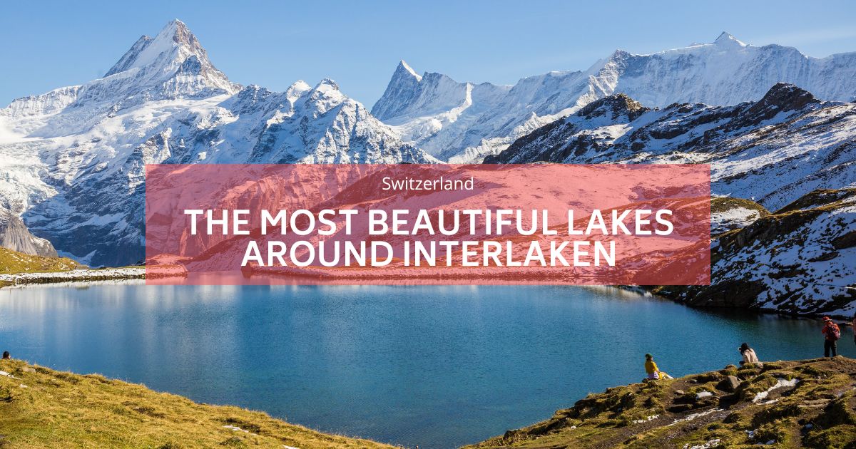
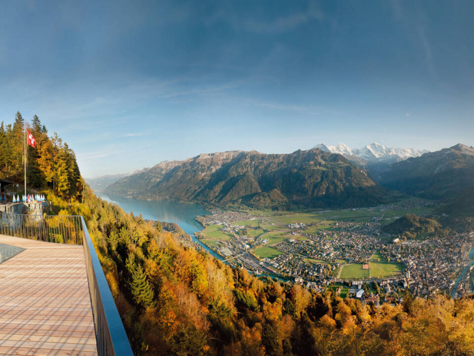
L'Harder Kulm è un punto panoramico a 1.321 metri nella regione dell'Oberland bernese in Svizzera, che domina le città di Interlaken e Unterseen. In cima c'è un meraviglioso ristorante che sembra un piccolo castello da cui si può godere della magnifica vista a volo d'uccello di Interlaken.
Puoi camminare fino all'Harder Kulm?
L'Harder Kulm è il punto di partenza di numerose escursioni in montagna. Puoi anche camminare da Interlaken fino al Kulm invece di prendere la funicolare. Arrivare a Harder Kulm a piedi non è una lunga camminata. Si tratta comunque di un percorso impegnativo, su sentiero di montagna, con alcuni tratti in dislivello piuttosto elevato, che richiede fisicità e buone scarpe. Un classico a Interlaken, il cui punto forte è la magnifica vista dalla terrazza del ristorante.
Da dove iniziare l'escursione sull'Harder Kulm?
IL Harder Kulm l'escursione inizia alla stazione di Interlaken-Ost.
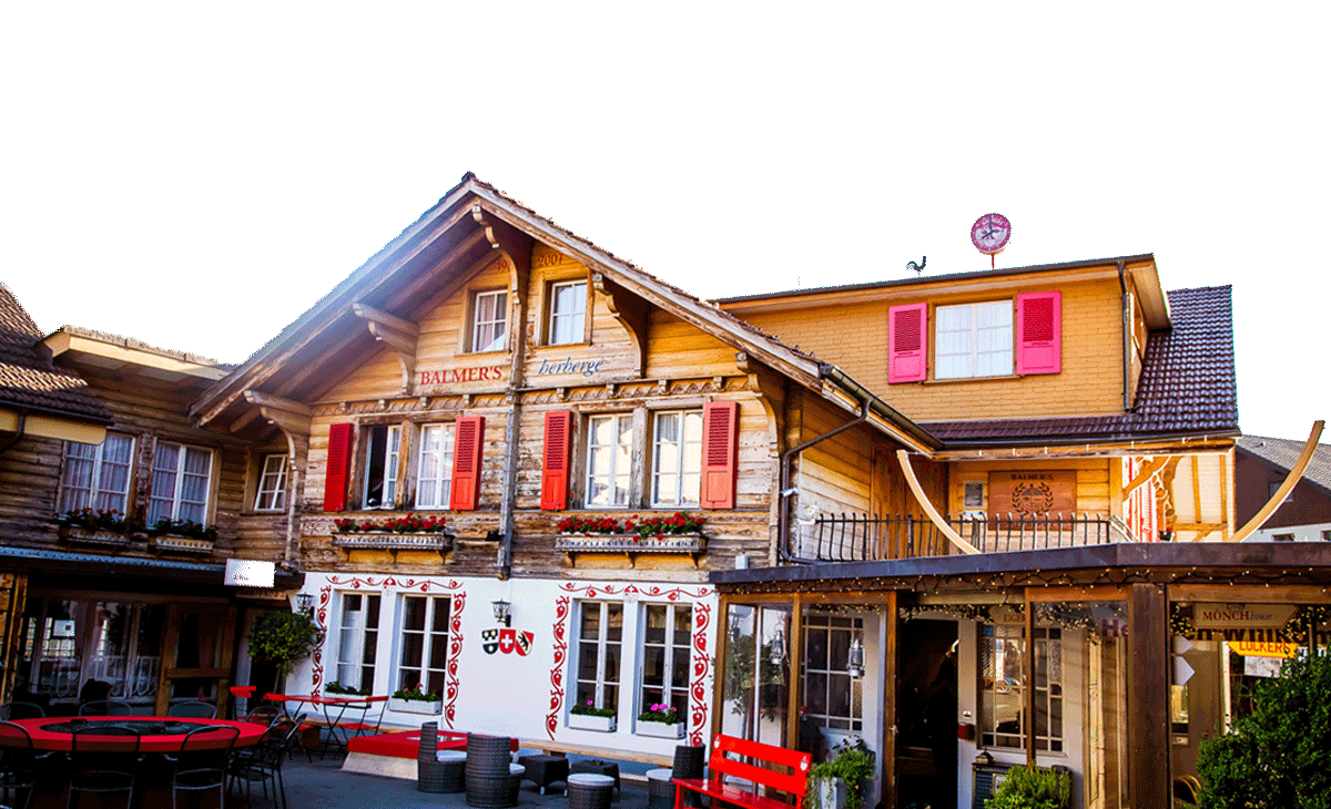
You can arrive by train at Interlaken-Ost station directly from Bern. If you are coming by car, there are multiple car parks available to you, see here. And from Balmers Hostel, è a 20 minuti a piedi.
Partendo dalla stazione, guardando tutto verso ovest, e poi camminando lungo l'Aare fino al ponte, attraversandolo, e dirigendosi verso la stazione della funicolare che sale all'Harder Kulm.
Escursione sulla cima dell'Harder Kulm
The start of the climb, which is right next to the funicular station, does not give you time to warm up. It goes straight up.
Most of the hike is in the forest and constantly climbing. Some sections are quite steep. You might meet a lot of people who go down, and therefore few who go up. The path is not very wide with many bends.
Now and then, in the forest, allowing you to catch a glimpse of the view that grows in as you climb. You will cross the lines of the funicular several times. And at the end of a clearing, the path is even flat in some places. That means that the end is not far away. Last climb, small, very tight bends, and then you will tumble in front of the restaurant with the pointed roof. At first glance, it looks like a small castle.
Go directly to the terrace, which is called the bridge of the two lakes. Lake Brienz is on the left, and Lake Thun is on the right. This is the best place to see the distinct colors of the two lakes.
- Da Harder Kulm puoi anche iniziare il Escursione sull'Augstmatthorn.
Scendendo in funicolare
You can take the funicular to go up as well as to go down, but the funicular is not in operation all year round. It is generally closed from December to mid-April. Find out before if you are not going to walk back down. See the Sito web di Harder Kulm qui per date esatte, prezzi e acquisto di biglietti.
We would also like to point out that while the Harder Kulm looks easy enough to reach on foot, it is a hard hike. Its close appeal from Interlaken is misleading. The trail is a steep mountain path and therefore requires special conditions such as good footwear and a trained hiking physique. Too often, I see people on the trail, not equipped and poorly trained, undertaking the ascent and, unfortunately, suffering from it. The hike must be fun, you have been warned ......