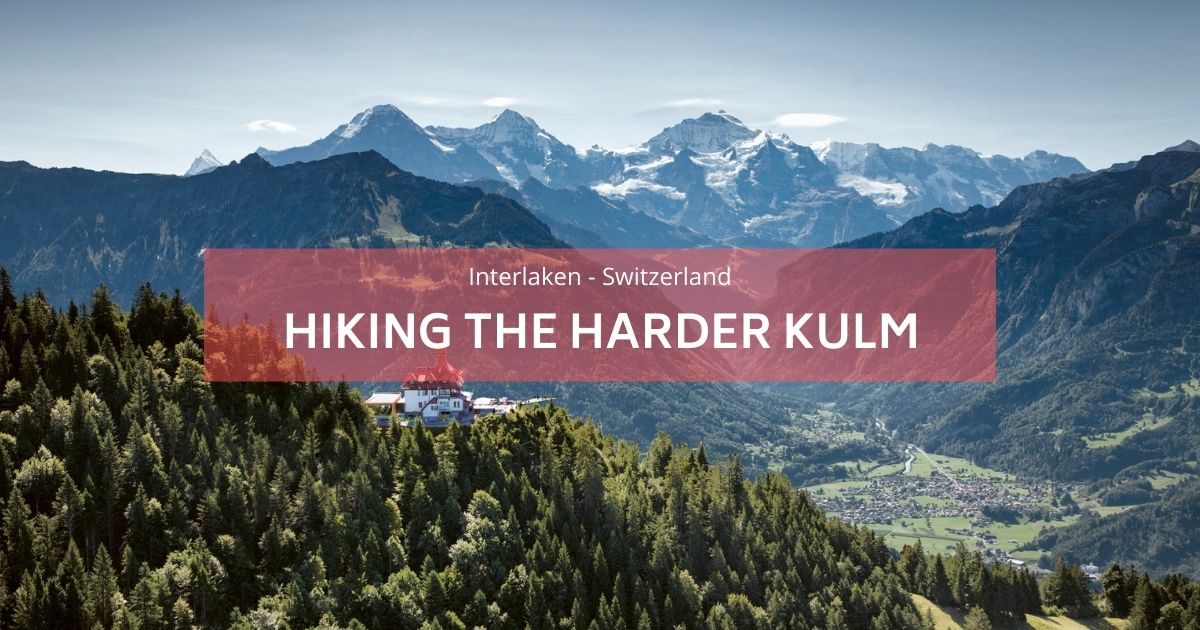
Dicono che sia una delle escursioni più pericolose al mondo
Escursione sull'Hardergrat
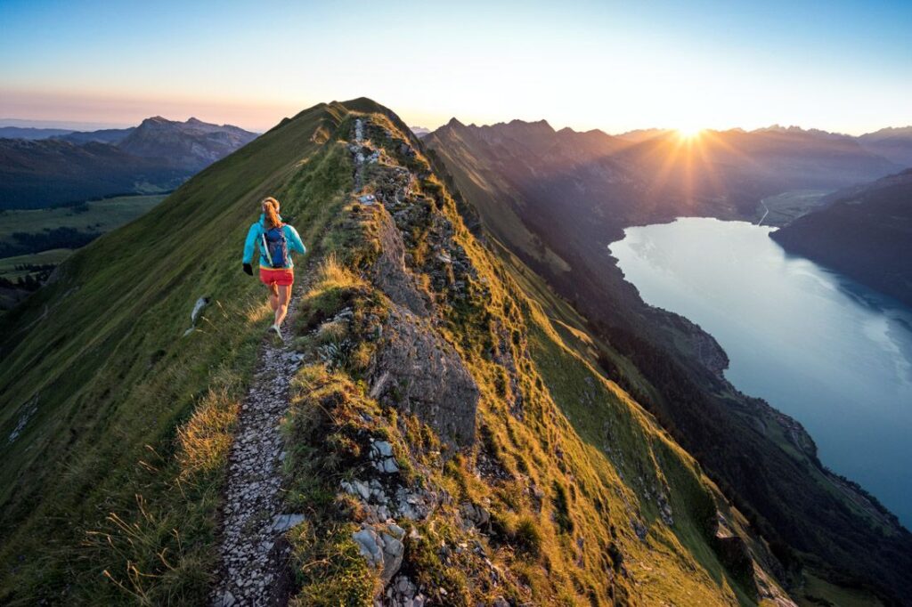
L'escursione Hardergrat è davvero unica e sorprendente. È uno dei le escursioni giornaliere più difficili della Svizzera e anche uno dei più pericolosi. Salire su una montagna fino in cima, camminare sul crinale fino a un'altra cima, con un grande lago turchese accanto a te e viste mozzafiato sulle cime innevate in lontananza. Un must da fare se sei qui. Il sentiero inizia a Brienz e costeggia il Brienzersee (Lago di Brienz) fino alla stazione Harder Kulm.
The Augstmatthorn hike is well worth mentioning—it's a shorter alternative to the more challenging Hardergrat trail, yet no less thrilling or breathtaking. With incredible views along the way, we highly recommend starting with this hike to build confidence and enjoy the adventure! Read here a complete article about the Escursione sull'Augstmatthorn.
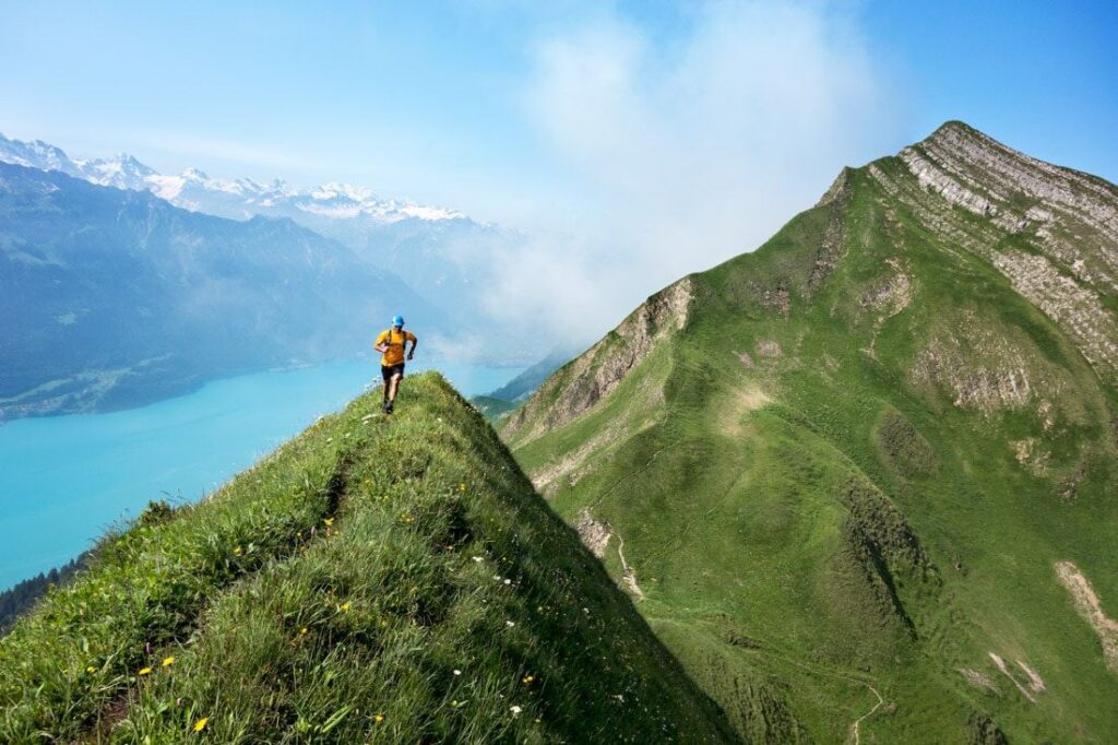
Non lo chiamano Hardergrat Trail perché è facile, se capisci cosa intendo... è classificato come uno dei migliori trail running ed escursioni giornaliere al mondo. Corre lungo il lago di Brienz fino a Interlaken in Svizzera con quasi 20 km di sentiero su una pista stretta e a filo del rasoio.
Ci vogliono circa sei ore per gli escursionisti in forma per completarlo e ci sono molte parti con dislivelli molto, molto ripidi. Questo è per escursionisti esperti e per evitare giornate piovose. Le ripide scogliere possono essere spietate. È possibile prendere il treno fino a Brienz e poi scendere da Harder Kulm, quindi non vi resta che camminare lungo il crinale, ma dovrete camminare velocemente e con determinazione perché se perdete l'ultimo treno scenderete altri 800 metri di dislivello.
La soluzione migliore è prendere il treno il prima possibile (metà prezzo) fino a Brienz, poi camminate lungo il crinale fino alla stazione di Harder-Kulm e assicuratevi di prendere l'ultimo treno. In alternativa, se sei un escursionista, puoi salire al Brienzer Rothorn, lungo la cresta fino alla stazione Harder Kulm, poi giù fino a Interlaken per un totale di quasi 30 chilometri e oltre 3000 m di dislivello. il giorno.
Preparazione per il sentiero
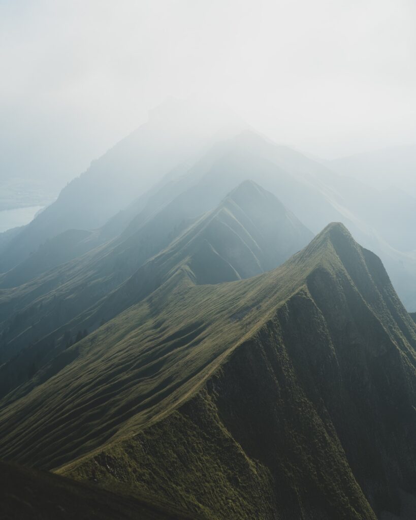
Questa escursione è per lo più disponibile da giugno a settembre. L'Hardergrat offre la particolarità di una vista a 360 gradi su tutto il suo percorso con il Lago di Brienz come orizzonte. Questo percorso è tanto aereo quanto tecnico. Soggetti a vertigini astenersi. Tanto più che, una volta lanciato, non c’è per così dire via di fuga né via di abbandono.
Per il bene della montagna e per l'amore delle vette, che vetta meravigliosa da conquistare. L'Hardergrat non è per i deboli di cuore. Soprattutto perché ci sono parti dell'escursione esposte a dislivelli di centinaia di metri, non un modo divertente da percorrere. Ma coloro che osano sfidare questa cresta, saranno ricompensati con alcuni dei panorami più belli della Svizzera, così come che tutte le Alpi hanno da offrire.
- Partenza: vetta del Rothorn Brienzer (locomotiva da prendere da Brienz) a 2350 m.
- Arrivo: Harderkulm (ristorante e piattaforma panoramica) a 1322 m. La discesa a Interlaken avviene con la funicolare. O a piedi ovviamente se ne hai ancora un po' nelle gambe.
E' possibile effettuare il percorso anche nella direzione opposta. - Da tenere in considerazione: su questo percorso non è presente alcun punto d'acqua, è quindi necessario fornirne abbastanza. Questo percorso è percorribile solo con tempo perfettamente asciutto (compresi i giorni precedenti l'uscita) e sereno.
- Livello: molto difficile
- Tempo: il completamento richiede in media 10 ore
The Hardergrat is not just a trail. It's an adventure where you will have 3000m of vert and plenty of ups and downs in more ways than you can imagine.